Smart Delta integrated Exwayz SLAM into its Smart Pano Gen2 and Smart Pano Elite mobile mapping solutions to significantly enhance georeferencing accuracy and point cloud quality for large-scale 3D spatial data capture.

Accurate spatial data as a foundation for safer, smarter cities
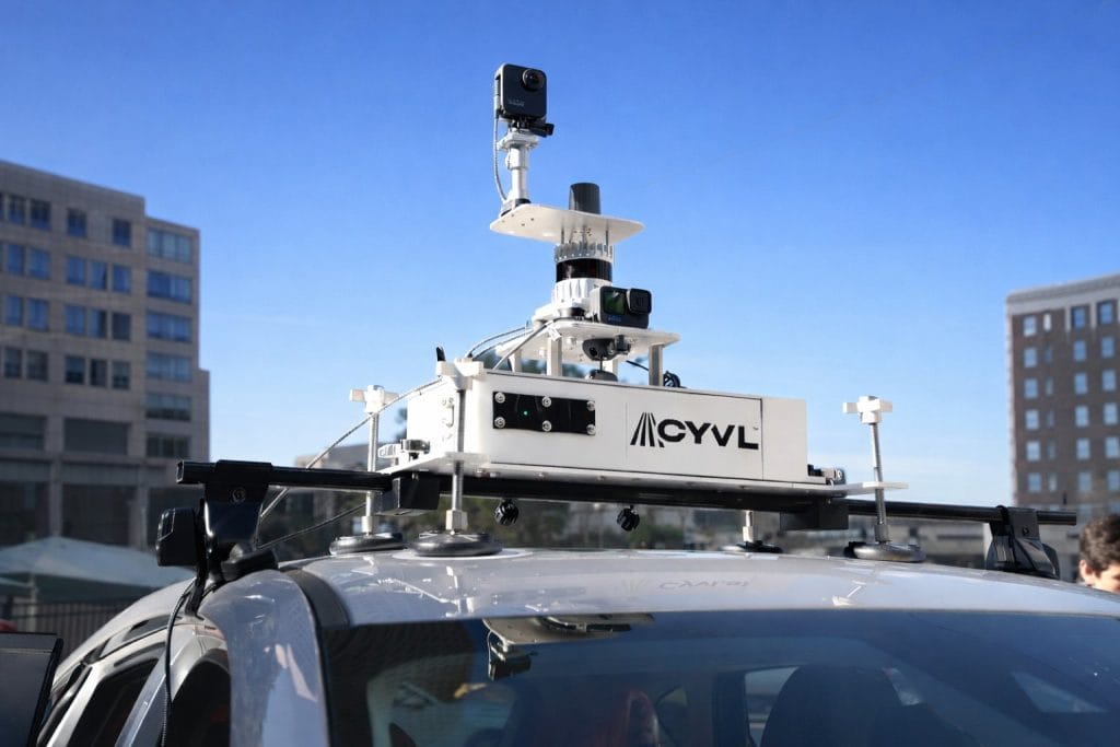
Smart Delta develops Smart Pano Gen2 and Smart Pano Elite, advanced mobile mapping systems delivering high-resolution 360° imagery and 3D spatial data for infrastructure management, urban planning and digital twin creation. Their solutions support municipalities, surveyors and private enterprises in capturing precise environmental data efficiently.
Because decisions are only as good as the data behind them
Smart Delta addresses the need for reliable and highly accurate spatial data that informs critical decisions in urban development, transportation planning and asset management. Incomplete or misaligned datasets can lead to costly mistakes, safety risks and inefficiencies in maintenance workflows. High-quality 3D point clouds and accurate georeferencing are therefore essential to drive actionable insights and maintain trust in digital models of physical environments.


The hidden complexity behind reliable 3D mapping
Smart Delta faces challenges in delivering datasets that meet the highest standards of accuracy and usability:
- Offline georeferencing precision: Ensuring point clouds from large survey areas align perfectly with existing maps and GIS data.
- Point cloud quality: Maintaining clean, dense and accurately colored 3D reconstructions, free from noise or artifacts caused by moving objects or environmental factors.
- Post-processing efficiency: Providing tools to automatically classify objects and remove dynamic elements while retaining full spatial fidelity.
These challenges are critical for applications such as digital twin creation or urban planning, where errors in georeferencing or point cloud quality can have significant downstream consequences.
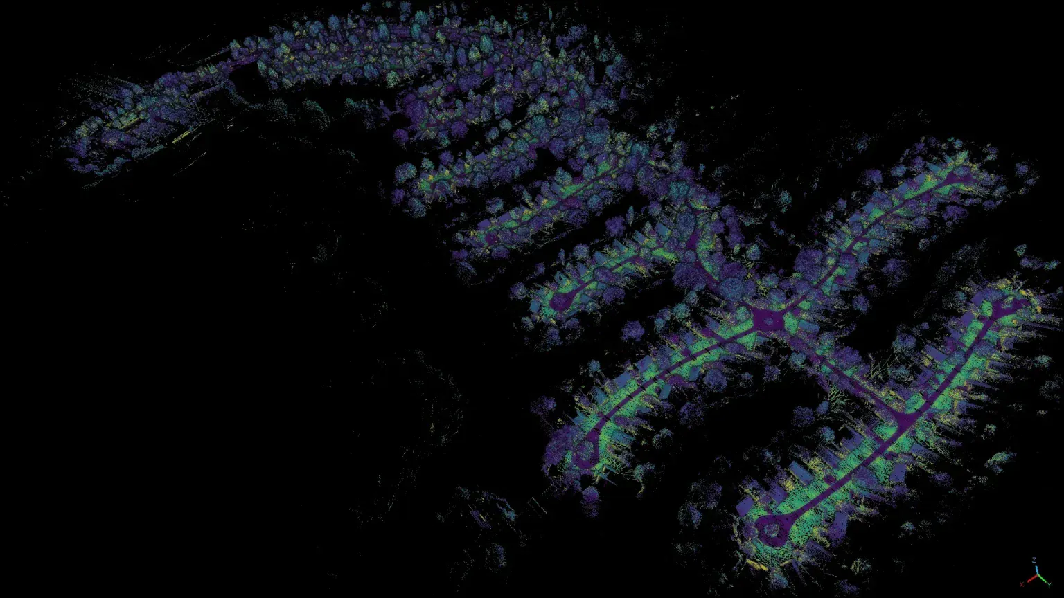
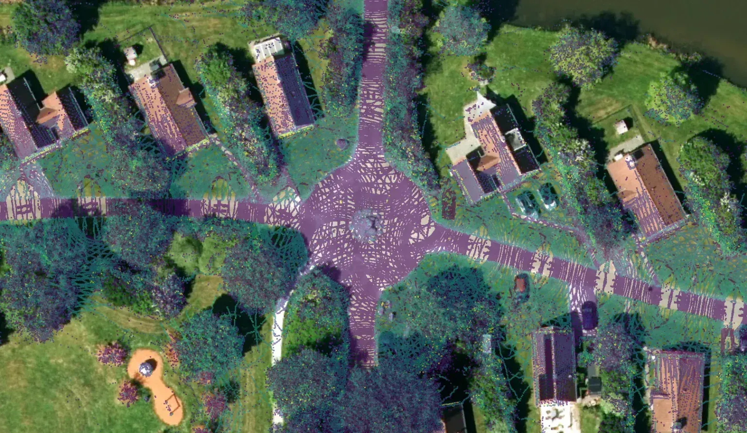
A localization and mapping backbone built for survey-grade mapping
- High-precision georeferencing: Exwayz SLAM ensures centimeter-level accuracy for offline point cloud alignment, even in GNSS-compromised environments such as urban canyons and tunnels.
- Point cloud colorization: Automatically fuses LiDAR and camera data to produce fully colored point clouds, enhancing visualization and interpretation.
- Advanced point cloud processing: Built-in tools allow dynamic object removal, classification and filtering, reducing post-processing time while maintaining spatial fidelity.
- Seamless integration: Lightweight, embedded software fits directly into Smart Delta's mapping pipeline, enhancing output quality without requiring complex reengineering.
Together, these features empower Smart Delta to deliver clean, accurate and actionable 3D datasets ready for GIS systems, digital twins and engineering analysis.
"Exwayz SLAM has transformed the way we capture and process 3D data. The combination of high georeferencing accuracy and advanced point cloud tools means our Smart Pano Gen2 and Smart Pano Elite customers get reliable, actionable data faster than ever before."Rene Bolhuis, CEO at Smart Delta